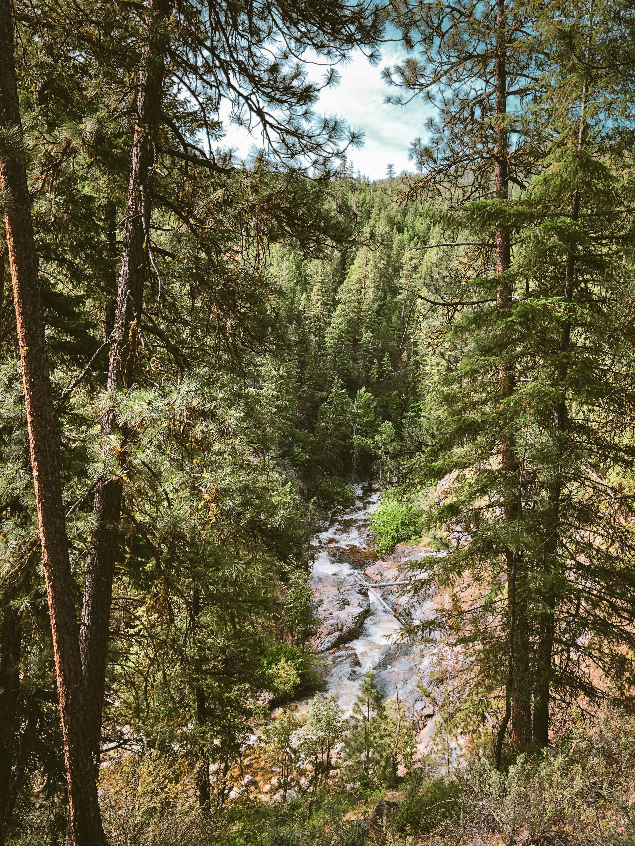
The Methow Valley is a soft landing in a rugged region – an easygoing realm of rolling shrub-steppe foothills and golden light backdropped by formidable alpine architecture. An idyllic gateway to Okanogan country, the Methow forms a gentle buffer between the North Cascades’ skyline of sawblade peaks and the Okanogan’s bristling highlands and lazy river valleys – a rain shadow that hits all the right beats.
So what’s a rain shadow? The oversimplified version goes something like this – weather systems move according to prevailing winds. In the Cascades that means west-to-east, in from the Pacific ocean, encountering mountains along the way. The mountains force precipitation on the windward side as heavy, moisture-laden air masses are driven up and over high elevation landforms where they expand and cool. Let’s say these mountains are really big and there are lots of them. Maybe they’re called the North Cascades.That means lots of precipitation on the way up and over the top and lots of unburdened air masses on the way down the other side. As air descends the leeward side, it warms, having lost much of its moisture. Accelerating things further, a process called adiabatic compression increases the amount of moisture the air can absorb as it descends – giving us arid, semi-arid and sometimes high desert regions on the leeward sides of mountain ranges. So that’s a rain shadow.
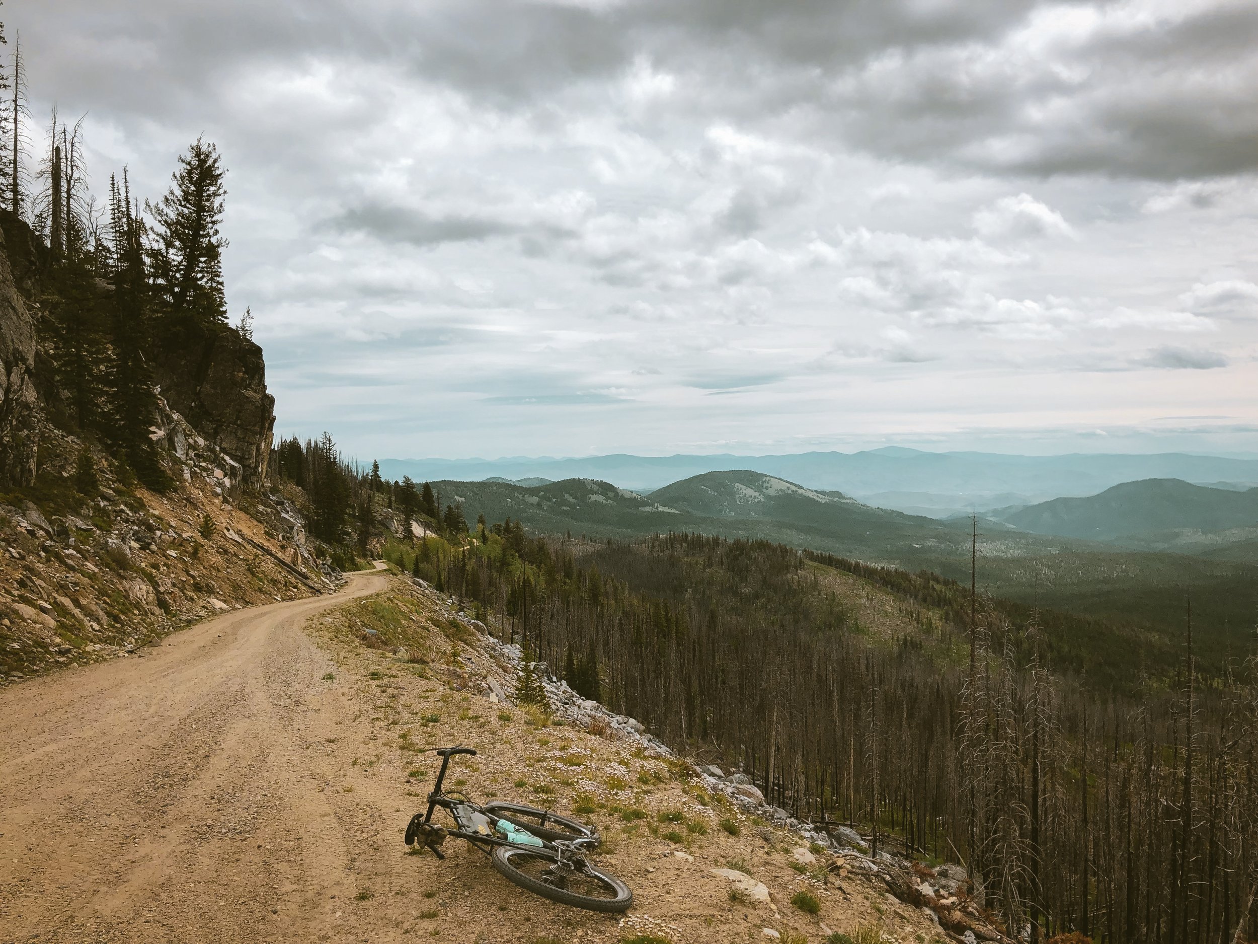
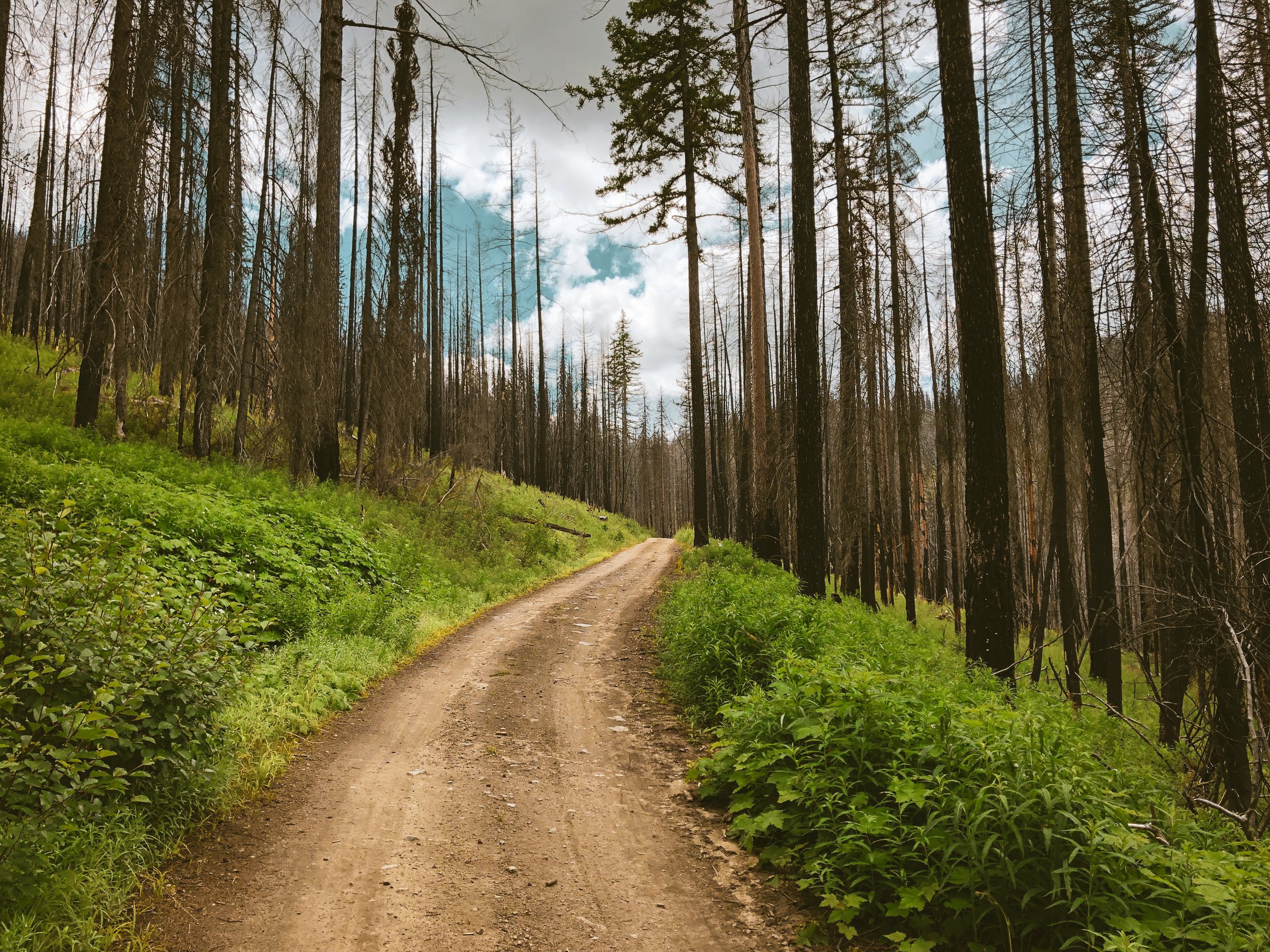
This spirited 85 mile gravel circuit out of Winthrop showcases a glorious cross-section of the Okanogan highlands, much of it in and among the bristling ghost forests of the Tripod, Okanogan and Calton Complex wildfires. The loop consists of two major climb/descent sequences: Baldy Pass and West Fork near Loup Loup. Also noteworthy and adjacent to this second West Fork pass is a wonderful, if not slightly tortuous climb to the nearby Buck Mountain fire lookout. While much of this circuit pushes into the high country of the Okanogan National Forest, the back end traverses the Methow’s lower foothills and bucolic agricultural valleys, dipping into the town of Twisp where there are plenty of available food, coffee and service options before the pushing onward toward Elbow Coulee. The final stretch closes out the loop with a gentle paved descent back into Winthrop.
As presented, this loop falls squarely into the gravel camp, consisting entirely of backcountry forest roads intercut with stretches of tarmac in town, but it does intersect quite a bit of high quality singletrack. These trails range from highly developed mountain bike networks (Sun Mountain Trails) to off-season nordic ski trails (Bear Mountain) to proper backcountry singletrack (Lightning Creek/Golden Staircase/Starvation Mountain) in addition to the 120 miles of the Methow Trails system connecting Winthop and Mazama. Trailheads are marked with POI within the route, which can be configured a la carte to include or bypass as much or as little singletrack as you like. Do keep in mind that this is already a big day, so we wouldn’t recommend piling an epic mountain bike ride on top of the existing 9558 foot adventure loop, but different folks configure things in different ways and with all the great singletrack throughout the area, it is certainly worth consideration. As we like to say – we’re simply pointing out that it is there.
Carlton Complex Fire
On July 17, 2014, sustained winds of 35 mph blasted the Methow Valley, pumping oxygen into several small fires which ultimately joined and spread. A column of smoke stretched 30,000 feet high, dropping embers and igniting dry grasses, trees and other fuels over thousands of acres. Propelled by the fast-moving column of smoke and wind, the flames traveled all the way to the Columbia River. The 2014 Carlton Complex wildfire was the largest contiguous fire in Washington’s history. Within a single day, flames consumed over 160,000 acres of forest and rangeland and ultimately burned more than 250,000 acres in the midst of a brutally hot, dry summer. The wildfire, driven by strong winds and explosive growth, was unprecedented in its speed and intensity, destroying more than 300 homes in Washington’s Methow Valley.
Highlights
Climb to Baldy Pass (6382 ft) along NF37 through the Okanogan National Forest. This luxury gravel climb gains 4600 feet over 25 miles with relatively gentle gradients in the 3-7% range.
Dynamic post-burn landscapes present forests in multiple phases of recovery from Tripod (2006), Okanogan (2015) and Carlton (2016) Complex wildfires.
Well-signed and maintained backcountry National Forest roads. Easy. Predictable. No muss. No fuss.
Easy access to Starvation Mountain, Bear Mountain or Sun Mountain singletrack for additional configurations.
Can be ridden as one big day or broken up into two days for a bikepacking edition.
Established campgrounds and dispersed camping available along the route.
Ample options for food and resupply in Winthrop, Conconully and Twisp.
Plenty of available water sources for filtering. Primary filter spots marked as POI within the route.
Winthrop
Winthrop is a curious confluence of worlds. It presents like an Old West movie set, all sunbleached boardwalks and swinging saloon doors but with a premium granola-athletic sensibility that clearly caters to Seattle tastes. Like a Colorado mountain town in the early 80’s, the Methow is ripe with second homes and upscale lodges tucked into the periphery but prefers to lead with uncluttered rolling hills, meandering rivers and lazy pace to its comings and goings.
Old Schoolhouse Brewery serves up a well-rounded slate of craft brew standards with a rotating lineup of dank and hazy seasonals. The downtown Winthrop location is situated in – you guessed it – a cozy, old timey schoolhouse with primo riverside beer garden and patio. They are kind of the only craft brew game in town offering a menu of pub grub, burgers and salads. They now have two additional locations in the valley, a taproom in Twisp and the Mazama Public House.
The Copper Glance is a mixology-grade cocktail bar with a streamlined menu of drinking snacks, charcuterie and thoughtfully procured locavore favorites. I can personally vouch for the burrata di bufala and gruyere mac n’ cheese.
East 20 Pizza serves up a casual balance of high quality post-ride pies, salads and curiously extra-cold brews. Nonchalant ski bum vibes and a well-worn, dog-friendly patio lock in East 20 as a perfect go-to for quick, easy, hassle-free calories and beer.
Though we’ve never had the pleasure, we’ve heard good things about Arrowleaf Bistro. If things like consciously curated seasonal farm-to-table fare get you excited, this may very well be the spot for you. Very popular. Dinner only. Wed-Sunday.
Nine miles southeast of Winthrop in Twisp, Blue Star Coffee Roasters is absolutely 100% worth the trip. Think Coava or Puff Coffee in Portland – which is to say artfully prepared and regionally famous craft espresso, pour-over, drip coffee and pastries along with a full line of brewing gear, aeropress + pour-over kits, filters and accessories. Highly recommended for a mid-ride pick-me-up.
Rocking Horse Bakery does a distinct thing I like to call mountain town espresso, which is to say sometimes it’s less about the coffee and more about convenience, hearty food + grab n’ go options, location or some combination of all of these. Rocking Horse is exactly that. No more, no less.
Methow River Lodge & Cabins gets the job done and then some in a rustic riverside setting close to downtown. All the stuff you need. None of the stuff you don’t with lovely balconies and hammocks right on the river. Perfect economically-inclined or solo option close to all the riding, food and fun.
Sun Mountain Lodge sits at the apex of the Sun Mountain trail system with singletrack literally out the front door. I’m not going to lie – it’s nice. You’ll find it comfortable, spacious, accommodating and slightly luxurious if you’re looking to splurge a bit. Of course it comes at a price but those North Cascade views from the hillside hot tubs will certainly help take the edge off.
Syilx Okanagan Peoples
Okanagan Country has been the ancestral home of the Syilx Peoples (Okanagan Band) for thousands of years, their traditional lands encompassing the entirety of the Okanagan Valley, from deep in the BC interior south to Grand Coulee and Lake Chelan in Washington.
The Syilx people believe that the earth was once a human being – the mother of all people, the soil is her flesh, the rocks her bones, the grass her hair, the wind her breath, and when she moves the earth quakes. These are the words of the Elders, recounted to the Syilx people since time immemorial. They are continually whispered from generation to generation, and are taken into their hearts, and shown through their culture. Syilx are among several indigenous peoples that view the earth as a living being, like a mother, comparing her winds to the soft lullabies sung to children, and her mountains and hills as extensions of her body. The syilx speaking people’s lands lie on both sides of the Okanagan River, east to the Selkirk range, west to the Cascades summit, south into Washington bounded by the Columbia River and Lake Chelan and north up to Salmon River.
85.5 MILES
9558 FEET
ROUTE FORMAT: LOOP
SURFACE: 85% backcountry Gravel, 15% Paved
TIRES: MINIMUM OF 38C. 47c IS IDEAL HERE.
SERVICES: Conconully, twisp & winthrop
ROUTE DETAILS
Terms of Use: As with each adventure route guide published on OMTM.CC, should you choose to cycle this route, you do so at your own risk.
1. The www.omtm.cc site and @omtm.cc Instagram account (collectively, the “Site”) are owned and operated by Our Mother the Mountain LLC (“OMTM”). The Site is primarily a creative project presented by OMTM and other contributors, but it is increasingly being used as a resource for other cyclists seeking challenging and compelling cycling routes. As such, we want to be clear about what the Site is and is not.
2. It is a creative project and may be used as (a) one resource (of many) for potential routes and (b) a source of inspiration for cyclists.
3. It is not designed to be a replacement for your own diligence and judgment. You should engage in significant additional diligence, and use your judgment regarding the route and your abilities, before embarking on any route described on the Site. You are solely responsible for obeying all public and private land-use restrictions and rules, carrying proper safety and navigational equipment, and following the #leavenotrace guidelines.
4. The information on the Site is for general information purposes only. While we made reasonable efforts to ensure the information was up-to-date and correct when it was posted, the information may be incorrect, incomplete, or outdated. We make no representations or warranties about the completeness, timeliness, accuracy, reliability, or quality of the information. Nor are we able to promise anything regarding weather, route conditions, or route availability. Everything is provided on an “AS IS” and “AS AVAILABLE” basis, and any reliance you place on information available through the Site is at your own risk.
5. Without limiting the foregoing, OMTM is not responsible for GPS content provided by third-party contributors or third-party sites or platforms (such as Discord, Google Groups, and Strava Club) that may be linked or referenced on the Site: we do not own or operate such sites or platforms and are therefore unable to vouch for any content on those sites or platforms.
6. Cycling is an inherently dangerous activity, and we are unable to control the actions of third parties (including without limitation other cyclists or users of the routes). As such, the Site is not designed (or able) to reduce or eliminate your risk of injury, death, or property damage. We assume no responsibility for injury, death, or property damage.
7. You and your heirs, personal representatives, and assigns, agree to indemnify, defend, and hold OMTM, its owner(s), and all OMTM contributors harmless from and against any claims arising out of or related to your use of the Site.


